 I went to the NOAA weather radar site just to see how big the cells were so I would know how long to expect the storm to last. To my surprise, I saw the ominous red box that indicates a local tornado warning sitting right next to the little dot that said “Cortez”! Had the weather radio been working we would have heard the warning warble. We didn’t have anywhere to go hide anyway, but I wasn’t too worried because it appeared the worst part of the storm was passing by just to the West of town, and we weren’t getting any wind. Nonetheless, I was pretty happy when the warning expired 15 minutes later. Didn’t think we would be dodging tornados up here in the mountains.
Cortez history is centered around the numerous native American tribes that call this part of the Southwest home. The town was established in the 1870's as a trading center. In the 1950's the oil and gas discoveries in the four corners area, as well as local tourism, became the primary economic factors supporting the town. Tourism is a mainstay because of the proximity of the city to the Four Corners monument, Mesa Verde National Park, and the Navajo Nation, with monument valley and Canyon De Chelly both within an day trip of Cortez. The town’s population is about 8,600 and it is the largest town in Montezuma County, and the county seat. The elevation is 6,200 feet.
One interesting fact that I found when researching Cortez is that on August 3, 1959, an Taiwan (Republic of China) Air Force pilot, Major Mike Hua, was flying a U-2 spy plane on a training flight out of a base in Texas in the middle of the night when the engine flamed out at 70,000 feet. The pilot did not know of any air fields in the area, but as he was gliding down he spotted a lighted airport that wasn’t on his map. He brought the U-2 in to a perfect dead stick
 landing at the Cortez airport, the only one in the area that was lighted throughout the night hours. This incident has since become known in aviation circles at the “miracle at Cortez.” Major Hua later received the U.S. Air Force Distinguished Flying Cross for bringing the aircraft in safely. At the time of the emergency landing the U-2 was a top secret project that was not known to the general public at all. The world was introduced to the U-2 nine months later, May 1, 1960, when Gary Powers was shot down over Russia while flying a U-2 spy mission. The Republic of China’s Air Force was the only other agency besides the CIA and the U.S. Air Force to fly U-2's, and a total of 28 ROC pilots were trained in the aircraft. The actual aircraft involved in this incident is on display in Palmdale, California.
Tuesday, July 19th, we left the coach after lunch to spend the day at Mesa Verde National Park. The park is only about ten miles East of Cortez and encompasses just over 80 square miles. The park was
 established in 1906 to protect a treasure trove of Anasazi Indian ruins dating back to 600 A.D. The entrance to the park is on the North side at an elevation of about 6,100 feet, however there are several points in the park that are over 8,000 feet
 and the majority of the mesa where most of the facilities and ruins are located averages about 7,500 feet. The park has about 45 miles of paved road and we drove all of them during our afternoon visit.
We first stopped at the visitor’s center to learn a little of the history of the area. When I was younger, growing up in Arizona, the term Anasazi was pretty widely used to designate the ancestors of many of the current Indian tribes in the Southwest. The term is Navajo
 and means, more or less, the ancient ones. The park has stated using the term Ancestral Puebloans for the peoples that populated the Mesa Verde area 1,400 years ago because it more closely aligns with the current native peoples that call themselves Pueblo Indians. According the scientists, the ancients came to the area about 600 A.D., stuck around for about 700 years, and then just left. During their stay they built numerous cliff dwellings, many of which are still in pretty good shape. They had the good sense to build most of their dwellings in the alcoves of the sandstone cliffs lining the numerous canyons that cut through the mesa. This protected them from the weather, and also protected their buildings after they left.
We spent the entire afternoon driving around the park, stopping at all the different overlooks and taking lots of pictures. The park is quite beautiful and the ruins are amazing to look at.
 We didn’t take any of the available walking tours, some of which take you right into some of the ancient buildings, because the heat and the altitude would be a little too much for Jackie, and probably for me as well. We still had a great visit and learned a lot about the Indian culture of the time.
After touring the park we stopped at the Cortez Elks Lodge for a quick visit. The lodge is just outside of town and is located right next to a City owned golf course. The building looks like a country club and we first thought that the lodge had taken over an existing building, but a member told me that the lodge built the building more than 30 years ago. It is large with a nice restaurant, ballroom and bar. The bar is big and has big windows overlooking the golf course. There were a couple dozen people in the place for happy hour and some of the patrons were pretty friendly, although the bartender was not. We did get a lodge pin for our banner since we have never visited this lodge before. After the Elks we headed home and relaxed the rest of the night.
Wednesday, July 20th, we decided we needed a stay at home day. Seems like we have been doing something every day for the last couple weeks. I did a couple of little chores around the house, like cleaning out our “file bay” where we keep all our papers and records. One of the issues with being true fulltimers is that we have to keep things like tax records and important papers somewhere in the coach. I had noticed a while back that it was getting a little disorganized, so I spent some time going through the stuff, shredding some old, unneeded paperwork, and straightening out the bay. Other than that, we spent the day relaxing, playing on the computer, and just enjoying the quiet. For dinner we BBQed a couple of magnificent rib eyes with all the fixings. A very nice day.
Thursday we left the coach about 11:00 for a day of geocaching. The first was only a few hundred yards from the RV park, at the Colorado Welcome Center across the street. We did four caches, then took a break for lunch at the Cortez Elks Lodge. There was a pretty good lunch crowd, most of whom looked like they had just finished a morning round of golf. It is clear that this lodge has a big group of golfing members. I guess they picked the right location. Lunch was pretty good, although the menu was standard lunch fare, burgers, sandwiches and salads.
After lunch we went back to caching and went North out of Cortez to the little town of Dolores, about 15 miles North. Dolores was established in the late 1800's as a railroad stop on the Rio Grande Southern railroad system. Today the town had about 900 residents and relies on tourism and visitors to the nearby National forests and McPhee Lake. The town displays it’s railroad heritage with a restored train station and railway museum which features a fully restored and functional “Galloping Goose” railcar. One of the geocaches we searched for was located at the train depot and related to the Galloping Goose.
The Galloping Goose, of which there were actually seven different iterations built and used, was created by the Rio Grande Southern railroad back in 1913. The Goose is a cross between a truck and a train
 and is technically referred to by railroaders as a “motor.” The line built the first as simply an inexpensive maintenance vehicle which was used for many years. However, by the 1930's the expanding road system were allowing trucks and cars to haul people and goods around the area. The railroad was struggling to stay afloat and its infrastructure, tracks and bridges, were deteriorating and there was no money to repair them. In 1931 the railroad built the first commercial Goose. All of the "geese" were built in the railroad's shops at Ridgway, Colorado. The first was built from the body of a Buick "Master Six" four-door sedan. It was more conventional in its construction than the later geese, though it had a two-axle rail truck in place of the front axle. Part of the rear of the car was replaced by a truck stake-bed for carrying freight and mail. This was later enclosed and partially fitted with seating. Number 1, as it was known, was used for two years to carry passengers, US Mail, and light freight before being scrapped. A second "goose" was built in the same year from another Buick, but later versions used Pierce-Arrow bodies, except for #6, which was constructed partly out of parts taken from the scrapped #1.
Numbers 2 and 6 were constructed with two rail trucks, with the rear truck powered on both axles. Number 2 had an enclosed freight compartment (like a very short boxcar), while #6 had an open bed similar to #1 (but larger). It was used only for work train service. The other four had three trucks and were articulated in the same manner as a tractor-trailer truck. In these, the second truck was powered, and the freight compartment was essentially a conventional boxcar. In 1945 #3, #4, and #5 were rebuilt with Wayne school bus bodies (at least the front half) replacing the old Pierce-Arrow bodies. This provided more passenger seating and comfort. A year later they also received new war surplus GMC engines.
In 1950, when the railroad finally lost its mail contract (in favor of highway mail carriers), #3, #4, #5, and #7 were converted for tourist operations, Large windows were cut in the sides of the freight compartments, and seating was added. This service lasted only two years before the railroad finally went bankrupt and shut down. Interestingly, six of the seven motors built remain intact and functional. Three are at the Colorado railroad museum in Golden, Colorado, one is on display in Ridgway, Colorado, one is here in Dolores, and one is at Knott’s Berry Farm in California. Only #1 was lost completely when it was dismantled and bits and pieces used on other motors. I remember seeing the one at Knott’s Berry Farm years ago when my kids were little.
After Dolores we continued our caching, ultimately ending up with a dozen new finds with no DNFs. About 4:00 we finally decided we had enough heat and we went back to the coach for the rest of the night.
Friday, July 22nd, my daughter Tracie’s birthday. Happy birthday Tracie! Today we left the coach after lunch and headed Southwest to Four Corners, about 40 miles or so. Four Corners is where the states of Arizona, Utah, Colorado and New Mexico meet. It is the only place in the USA
 where four state borders meet at a single point. The location is actually on the Navajo Reservation and is a Navajo Tribal Park. There is a modest charge for admission. Except for the monument the area is bleak and desolate, truly out in the middle of no where. The monument itself is very nicely done with a large concrete plaza surrounding the brass plaque the marks the spot where the borders meet, along with the four
  state flags, the US flag and the Navajo Nation flag. The plaza is surrounded on all four sides by concrete sales stalls where local Indians set up booths selling jewelry, tee shirts and other trinkets. We took the requisite picture of Jackie standing in four states at once. (Families were lined up to be next for the picture) We then shopped the booths. Jackie got some nice hair decorations and we picked up a Four Corners pin for our banner. We also stopped for a big piece of hot, fresh Indian fry bread. Yum.
 After our visit to the monument we started back towards Cortez and did some geocaching along the way. We ended up with five new caches before we decided it was getting a little late in the afternoon. We made a quick stop at Wally World for some supplies before heading back to the coach for the rest of the night.
Saturday, July 23rd, was a travel day again. This time we were only going a little less than 50 miles East to Durango, Colorado. Since we didn’t have far to go we didn’t leave Cortez until just before 11:00 and
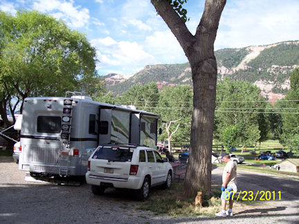 still got into Durango at noon. Durango is just a couple hundred feet higher than Cortez, about 6,500 feet, but the surrounding mountains and valleys are much greener and more “Colorado looking”
  than the area around Cortez. We settled into the United Campground of Durango, which is on the North end of town. Our camp site overlooks the tent camping area, a large green space full of tents and people. The railroad tracks for the Durango-Silverton excursion train run between our motor home and the tent sites. Since there are three or fours trains per day we should have plenty of opportunities to see the trains in the mornings and evenings.
After lunch we drove into Durango proper just to cruise around and see the town. We drove through some of the residential areas, which are very nice for the most part, and parked in the historic downtown area. We spent about an hour walking around old downtown, which is very picturesque, looking in the shops. We also drove through the campus of Fort Lewis College, which is located on the top of a high mesa on the east side of town. I never heard of the school, but it has a very large, very pretty campus. The sign said it was founded in 1911.
Durango was founded in 1881 by the Denver and Rio Grande Railroad as a transportation center for the gold and silver mining going on in the area at the time. It now relies on tourism for its primary economic support. The Durango-Silverton railroad brings thousands of people every year to the town.
 The line used by the excursion trains is a remnant of the old D&RG line. Rafting the Animas River, which runs right through the middle of town, is also a big attraction. Every time we caught a glimpse of the river while we were touring we saw it was full of rafts and kayaks.
 After our touring we went back to the RV park and sat outside with our cocktails waiting for the trains to arrive back from Silverton. The first one showed up about 5:30 or so and chugged by just a few yards in front of our motor home. Since there is a grade crossing going down to the tent area
 right next to our site, the train blows it’s whistle just as it approaches our site. Damn that thing is loud! It was fun to watch the kids, and even some adults, from the campground putting coins on the track for the train to run over. I remember doing that when I was a kid living in Tempe, Arizona. We watched the other two trains go by later in the evening before retiring to the coach for the rest of the night.
Sunday, July 24th, we went out after lunch to do some geocaching in the Durango area. We had thought that there would be a lot of urban caches in the downtown area, but we were surprised to find that there weren’t any right in town.
 There were a lot in the surrounding area, however, but some of them were pretty tough. We managed to find six in a couple of hours, along with one DNF. It was very hot and humid, so about 4:00 we stopped caching and headed to the Durango Elks Lodge for a cocktail.
The Durango Elks were chartered in 1899 and they are still occupying the building that they built in 1925. The building is a four story block building located near the historic downtown. The inside is very nice, not real elaborate, just tasteful opulence. It has the very high ceilings that were popular in the day and everything is divided by archways. There is a ballroom on the bottom floor, which they rent out. The clubrooms and bar are on the “main” floor. The building is built on a hillside, so the second floor is at street level in the front of the building, which is the main entrance. The bar was very full when we got there and the folks were very friendly. We chatted with the bartender for a while and she told us that the lodge had about 550 members. We had two cocktails, the lodge bought our second, and also got a lodge pin for our banner.
I went for a little tour of the lodge while we were there because I wanted to see their Lodge room. Like most of the lodges that are still in the old, early 1900's buildings, they have a dedicated Lodge room on the third floor that takes up most of the floor. It is very nicely decorated with great lighting and furniture. Again, not real flashy, but very dignified. The top floor looked like it was just used for storage. After our visit to the lodge we went back to the coach for the rest of the night. We did sit outside for our happy hour watching the trains coming back from Silverton.
Monday, July 25th, Jackie’s brother Dennis’s birthday. Happy birthday Dennis! We left the coach around 10:00 for a driving tour. We went North out of Durango on US 550, heading for
 Silverton, about 50 miles North, and then Ouray, Colorado, another 25 miles North of Silverton. We will be going to Silverton on the train tomorrow, but we only have a couple of hours in town and we wanted to make sure we saw it all. In addition, the train and the highway take two completely different routes to Silverton. The train follows the Animas River canyon for the majority of the journey, while the highway follows the ridge lines and goes over the passes. We also wanted to see Ouray, which is beyond where the train goes. The highway goes across two nearly 11,000 foot passes on the way to Silverton.
We arrived in Silverton about 12:15 and went to a place called Thee Pitts Again BBQ house. The owner also has a place in Glendale, Arizona, which was featured on Guy Fieri’s Diners, Drive-ins and Dives show.
 The place in Silverton has the same menu and recipes, so we wanted to give it a try. The entire building, inside and out, was painted in shocking pink, as was an old Chevy panel truck parked by the front door. Since two of the days trains had already arrived by time we got to town, the place was busy, but it was worth the wait. We both had the pulled pork sandwich, which was wonderful. We also had the onion rings which had been featured on the show, and they were also great.
After lunch we spent a couple of hours walking around the town, looking in stores and just window shopping. We both marveled at how much the town reminded us of some we were in while we were touring the Yukon and Alaska
 a couple of years ago. Old block and wooden buildings, dirt streets and the backdrop of snow capped mountains. Only the main street was paved, everything else was dirt. Silverton sits at an elevation of 9,318 feet and grew from an bunch of gold-rush mining shacks in the early 1870's to a community of mostly Victorian structures, most of which still stand. The entire town is designated as a National Historic Landmark. Gold mining gave way to silver in the 1880's and production continued at modest levels even after the collapse of the world silver market in 1893. The last working mine closed in 1991, and the town now relies almost entirely on tourism. A scenic road, locally called the “Million-Dollar Highway,” forms a part of the San Juan Skyway and connects Silverton to Durango and Ouray. The Durango & Silverton Narrow Gauge Railroad, which runs in the summer months, is a major attraction and uses the same lines and rolling stock as the original Denver & Rio Grande line did. There are three or four trains per day, each with several hundred people, so the tourist trade is vibrant. The town has about 16,000 population, compared to about 5,000 at the peak of it’s mining days.
After spending a couple hours in Silverton we continued North to the town of Ouray (pronounced you-ray). Although only about 25 miles, the road between Silverton and Ouray is very curvy and goes over the Red Mountain pass which tops out at over 11,000 feet. Because of its location in the bottom
 of a fairly narrow canyon with tall peaks all around, Ouray likes to call itself the “Switzerland of America.” Originally established by miners chasing silver and gold in the surrounding mountains, the town at one time boasted more horses and mules than people. Prospectors arrived in the area in 1875. At the height of the mining, Ouray had more than 30 active mines. The town—after changing its name and that of the county it was in several times—was incorporated on October 2, 1876, named after Chief Ouray of the Utes, a Native American tribe. By 1877 Ouray had grown to over 1,000 in population and was named county seat of the newly formed Ouray County on March 8, 1877.
The Denver & Rio Grande Railway arrived in Ouray on December 21, 1887. It would stay until the automobile and trucks caused a decline in traffic. The last regularly scheduled passenger train was September 14, 1930. The line between Ouray and Ridgway was abandoned on March 21, 1953. The trains came from Ridgway to the North, rather than Silverton because of the Red Mountain Pass and lack of a good rail route between the two towns.
Ouray has an Elks Lodge, located in an old block building right downtown, however, it was not open when we were in town. According to the sign on the door, it is only open a few hours a couple of days a week. We did take some pictures of the building. We spent another hour or so walking around Ouray,
 looking in shops and checking out all the neat stuff. The town is much smaller than Silverton, only about 1,000 or so population. One interesting note for Country Western music fans is that in 1986 a man by the name of Bill Fries was elected mayor of Ouray and served a total of six years in that post. Most people know him better as C.W. McCall, the author and singer of the hit songs “Convoy” and “Wolf Creek Pass,” favorites of truckers to this day.
After touring Ouray we started back South on Highway 550, back towards Silverton and then Durango. All during our trip today we also did some geocaching along the way. We found a few on the way up to Silverton, and then a couple between Silverton and Ouray. We ended up with five new finds, along with a couple of DNFs. We finally got back to the coach around 5:00 and settled in for the rest of the night.
Tuesday, July 26th, we were up early and out of the coach by 7:30 a.m. (Yes, you read that right) Today is the day we take the train from Durango to Silverton and back. We are on the 8:30 train. We arrived at the station in time to see the 8:00 train depart, and then we boarded our car. Our car,
 originally built in the 1880's but completely rebuilt and restored, was a regular train car with standard bench seating. There are several classes of travel on the train, ranging from the regular coach, which we took, to luxurious parlor cars. The price difference was huge though, and it didn’t seem to be worth the upgrade. We did opt for the enclosed car instead of the semi-open gondola car. That turned out to be a good decision later in the day.
The train left the station promptly at 8:30 and started the 45.2 mile trip to Silverton. The Durango and Silverton Narrow Gauge Railroad (D&SNG) is a narrow gauge heritage railroad that operates 45 miles of track between Durango and Silverton. It is a federally designated National Historic Landmark and is also designated by the American Society of Civil Engineers as a Historic Civil Engineering Landmark. Narrow gauge means that the tracks are laid only three feet apart as opposed to the four foot, eight and one half inch distance for standard railroad tracks.
The route was originally built between 1881 and 1882, by the Denver and Rio Grande Railway, in order to carry supplies and people to and silver and gold ore from mines in the San Juan Mountains. The line was an extension of the D&RG narrow gauge from Antonito, Colorado to Durango. The last train to operate into Durango from the east was on December 6, 1968. The States of New Mexico and Colorado purchased 64 miles of the line between Antonito and Chama, New Mexico in 1970 and operates today as the Cumbres and Toltec Scenic Railroad. The trackage between Chama and Durango was abandoned and rails were removed by 1971.
The line from Durango to Silverton has run continuously since 1881, although it is now a tourist and heritage line hauling passengers, and is one of the few places in the United States which has seen continuous use of steam locomotives. In March 1981, the Denver & Rio Grande Western sold the line and the D&SNG was formed. Some of the rolling stock dates back to the 1880s. The trains run from Durango to the Cascade Wye in the winter months and run from Durango to Silverton during the summer months. The depot in Durango was built in January 1882 and has been preserved in original form.
The train takes 3½ hours to run the 45 miles each way, with a 2¼ hour layover in Silverton. The train spends the first hour going first through Durango and then the broad valley North of Durango. Of course, at the North end of town we passed our RV park and waved at Smokey in the motorhome. The train then starts to climb, ultimately reaching a peak on the stretch of track that is called the
 “highline” by the railroad. This is the most famous section of the railroad where the train crawls along the face of high cliffs with a sheer drop down several hundred feet to the Animas River. The speed limit on this stretch is five miles per hour, and it appears to be for good reason. There is no room for error on
 this part of the trip. After the highline section the track descends to just a few feet above the river and the roadbed closely follows the Animas River through a usually very narrow canyon. Just before Silverton the train breaks out of the canyon into the valley where the town sits. The scenery is magnificent, even the stretches that are only forest. We only saw one deer, and that was on the way back, but we were always watching for wildlife.
 The train crosses the river five or six times during the trip, so no matter what side of the train you are sitting on, you will have a great view at least part of the time. We visited the concession car
 once for a great coffee and Baily’s wake up just after leaving Durango. Once we got to Silverton we went to another of the local restaurants for lunch. After lunch we spent an hour or so looking around town in the various shops we missed the day before. We also did two new geocaches that were right in town, close to the train depot. One of the caches was rated "very easy" but stumped me for while.
  We then got back on the train for the three and one half hour trip back over the same scenery. This time we didn’t take as many pictures, but just sat back and enjoyed the ride and the great views. A good part of the way back we traveled through very heavy rain. This is when I was glad that we had the enclosed car because the folks in the open car behind us were getting pretty wet.
We got back into Durango about 6:15, got in the car and drove back to the coach, where we collapsed for the rest of the night. This was a great day and, although the train ride is not inexpensive, it is a great experience and we are glad we did it.
Wednesday, July 27th, we went out after lunch just to visit the local mall and get some walking done in an air conditioned setting. We spent a couple hours in the mall before going back to the coach for the rest of the night. Today was intended as just a relaxation day after the long day on the train.
Thursday morning we packed up the coach and departed Durango about 10:00, heading South back into New Mexico. Today’s trip was only about 50 miles and we stopped in Bloomfield, New Mexico for a couple of nights at the Desert Rose RV Park. Bloomfield is about 25 miles East of Farmington, where we spent a few days before going up into Colorado. Our arrival back into New Mexico marks a good stopping place for this chapter of the blog. We spent ten wonderful days in Southern Colorado and had a great time. We will be in New Mexico for another week or two before heading out into the prairie region for a while. Until the next time keep the faith and enjoy every day.


